Hiking Day and Night at Shenandoah 🔗
(Also published on DCSki.)I had been watching the weather forecast closely in the days leading up to Sunday, July 6. "Scattered thunderstorms and rain" stubbornly remained in the forecast, with the percent chance gradually rising as Sunday approached. But, if the forecast was going to remain stubborn, I could too: I wanted to go hiking in Shenandoah National Park, and I wasn't afraid to hike in the rain.
Thankfully, I found a friend with a similar philosophy who was also eager to hike, regardless of weather. J.R. and I hit the road at 8:15 a.m., heading to the Virginia mountains with plans to hike all day and into the night.
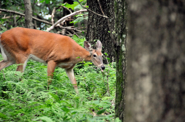 |
A deer munches on an early afternoon snack in Shenandoah National Park. Photo by M. Scott Smith. |
We arrived at the Front Royal entrance of Shenandoah around 10:30 a.m., and soon saw a wild turkey scramble awkwardly across Skyline Drive. Shortly before noon, we pulled into the Big Meadows campground and parked near the firewood store, ready to start the first of two hikes.
The weather was fairly pleasant: overcast, to be sure, but not precipitating during mid-day except for an occasional sprinkle. The temperature was in the upper 70's, but the humidity was very high and the ground was wet. The park seemed relatively uncrowded for the end of the Fourth of July weekend; scattered rain showers clearly had driven people away.
The first hike consisted of a circuit combining parts of the Appalachian Trail (AT), Rose River Trail, Dark Hollow Falls Trail, and the Story of the Forest Trail. This moderately-rated circuit has an elevation change of 1,400 feet and spans 6.4 miles. We started by walking to the Big Meadows amphitheater and then hopping on the nearby AT. We followed the AT to the Red Gate Road, and then followed that briefly to Skyline Drive. Crossing Skyline Drive, we hopped on the Skyland-Big Meadows Horse Trail, and then followed that left until it hit the Rose River Loop Trail.
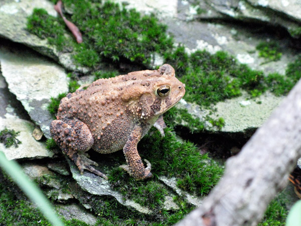 |
A fist-sized frog (or is it a toad?) stands on a rock near the Rose River Falls trail. Photo by M. Scott Smith. |
Rose River is a fun hike. Before too long, the trail catches up with Rose River, which has a number of small and large falls, including a 25-foot fall into a deep pool. The Rose River Trail also passes the remains of an old copper mine. You can make a loop out of Rose River by taking the Rose River Fire Road back to the Rose River trailhead, but you can also make a side jaunt to the base of Dark Hollow Falls.
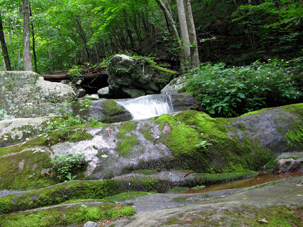 |
Water cascades over the rocks along the Rose River Trail. Photo by M. Scott Smith. |
Dark Hollow Falls is one of the largest falls at Shenandoah, and one of the closest to Skyline Drive. A fairly steep trail leads from Skyline Drive to the falls, and is one of the park's most crowded trails. After resting a bit just below the base of the falls, we hiked up the Dark Hollow Falls trail back to Skyline Drive. By now, the humidity hung over the air like a wet blanket. It would have been insufferable if the temperature were in the 90's. We worked up a sweat hiking to the top.
After hiking south down Skyline Drive, we hopped onto the Story of the Forest Trail, which leads through the woods back to the Big Meadows campground. This completed the first hike.
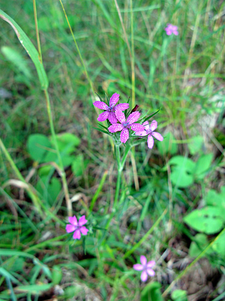 |
Flowers along Skyline Drive. Photo by M. Scott Smith. |
The goal of the second hike was to climb a peak, hopefully capturing a good sunset, and then hiking back in the dark. But we had some time to kill, so we drove south along Skyline Drive, eventually arriving at the Loft Mountain Wayside, located at the 79.5 mile mark. This Wayside has a gas station (around $4.29 a gallon), a quaint gift shop, and counter food service with all the grilled staples a hungry hiker might crave.
After checking out the Wayside, we turned around, and drove north along Skyline Drive about 35 miles to the Lower Hawksbill trailhead. At 4,051 feet in elevation, Hawksbill is the highest peak in Shenandoah. An 0.8 mile hike up 750 feet will take you from the trailhead to the peak. When we arrived at the trailhead, a Park Ranger was providing medical assistance to a hiker who appeared to have banged up his knee. All of the trails were wet and slippery, so you had to be careful with your footing. Thankfully, he appeared to be OK and in good hands.
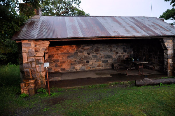 |
Byrds Nest 2 day shelter, providing protection from rain near the top of Hawksbill mountain. Photo by M. Scott Smith. |
We began the hike up to Hawksbill after everyone else had left. Halfway up, steady rain began to fall. The mountains were shrouded in fog by the time we reached the top, and a chilly breeze blew across the mountain. After a day of heat and humidity, the cool breeze felt great, but I found myself shivering before too long. Near the top of the mountain is the Byrds Nest 2 shelter, and we sat there for awhile, listening to the rain fall, with a gut feeling that the clouds and fog might break just before sunset.
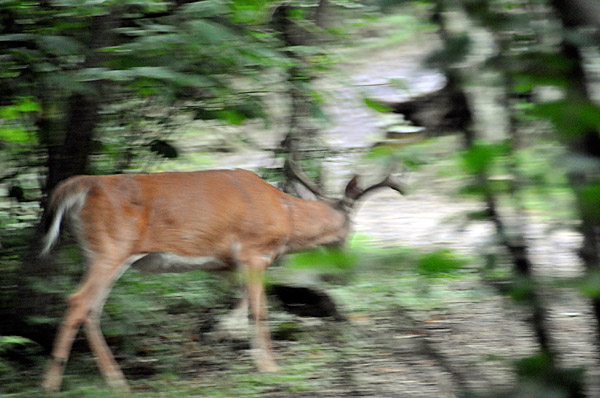 |
A camera-shy buck evades attempts to take an in-focus shot along the Lower Hawksbill trail. Photo by M. Scott Smith. |
Apparently, though, we were unwelcome guests. Every 30-90 seconds, a small bird swooped down into the shelter, saw us, and then made a quick U-Turn, flying out of the shelter and back to a nearby tree. We noticed a bird's nest in one of the rafters (which looked like an awfully nice, warm house, with a great view), and guessed this was the bird's intended destination. We became convinced that the bird either wasn't very bright, or had incredibly short-term memory, as it repeated its reconaissance flight dozens of times, in each case acting surprised that we were still there, even though it could clearly see us from its nearby perch in a tree.
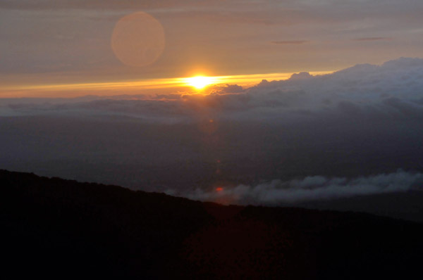 |
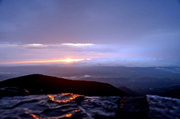
The clouds suddenly part just as the sun dips towards the horizon. Photo by M. Scott Smith. |
Although the rain continued to fall steadily, the clouds began to open up in the distance, revealing a setting sun. We made the short hike up to an observation platform at the peak, which provides a 270-degree view. At that moment in time, we probably had the best view in the entire state, as interesting cloud formations interacted with the sun, producing spectacular patterns and color to the west. But the east did not want to be outdone. To the east, a huge rainbow began to grow over the valley, eventually growing into a double rainbow. The sky would occasionally flash white with distant lightning. For 15 or 20 minutes, I think we were treated to what might possibly be one of the best views ever seen at the top of Hawksbill Mountain. Fourth of July fireworks had nothing on this. I've learned that some of the best sunsets follow rainy weather, and everything aligned perfectly at that moment in time to produce stunning views.
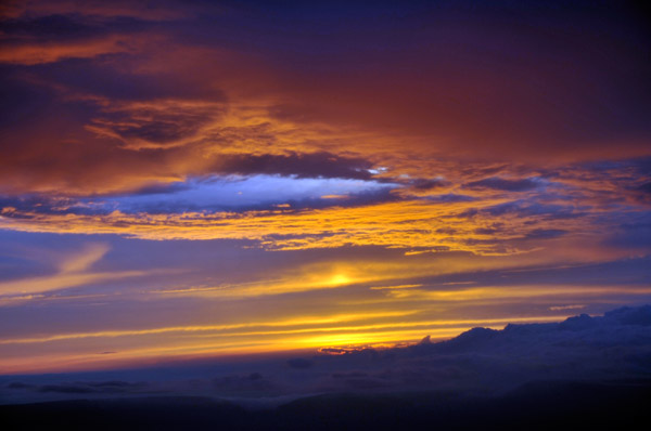 |
Photo by M. Scott Smith. |
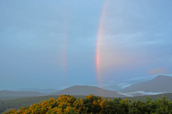 |
An enormous and complete double rainbow fills the view to the east. Photo by M. Scott Smith. |
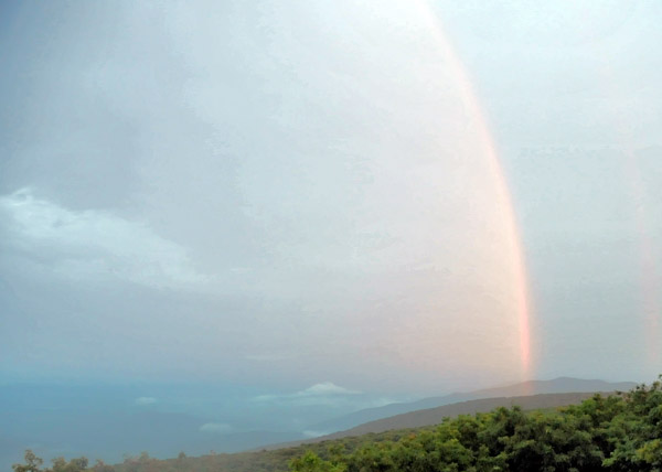 |
The right side of the rainbow. Would have been a good time not to leave the ultra-wide-angle lens in the car at the base of the trail! Photo by M. Scott Smith. |
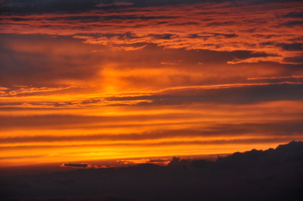 |
Photo by M. Scott Smith. |
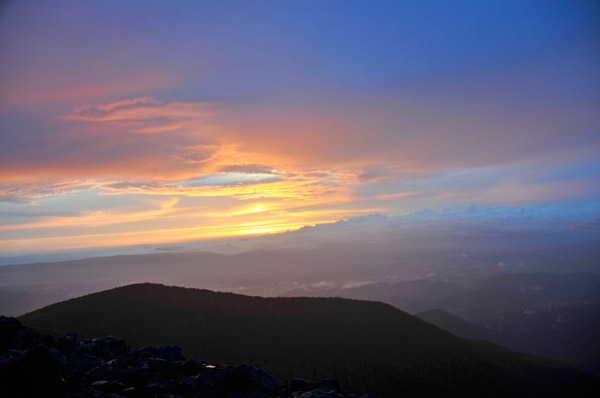 |
Photo by M. Scott Smith. |
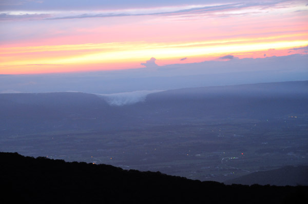 |
Fog billowing over the side of a distant mountain range creates the illusion of a waterfall. Photo by M. Scott Smith. |
 |
View from the top of Hawksbill Mountain, the highest peak in Shenandoah National Park. Photo by M. Scott Smith. |
Eventually the rainbows faded away, the sun settled under the horizon, city lights in the valley began to twinkle in the distance, and all light drained out of the still-rainy sky. Rather than taking the Lower Hawksbill Trail directly back to the trail head, J.R. and I decided to make a circuit hike by hiking an additional 2.1 miles (for a total of 2.9), first hitting the Salamander Trail and then intersecting with the Appalachian Trail for the trip back to the trailhead.
By now it was pitch dark, and we fired up our LED headlamps to light the slippery trail. We discovered that the Salamander Trail is very appropriately named; I counted dozens of small salamanders scurrying across trail. The salamanders appeared to be at an ironic crossroad of evolution; they looked like small snakes, but had tiny feet. As a result, their movement was less than graceful -- a fumbling flopping that looked like something between a slither and a crawl. Having seen how appropriately named the Salamander Trail is, I'm not sure I want to visit Rattlesnake Point Overlook, located further north in the park.
I thoroughly enjoy hiking at night. The woods take on a totally different character, and your senses heighten. You also see different types of wildlife. One type of wildlife I didn't care to see, though, was a leech, which hopped on my leg somewhere along the descent. I was able to pluck him off quickly, but it's the first time I've seen a leech at Shenandoah.
Back at the car, the only thing left to do was make the long drive home. I arrived home just after 1 a.m., exhausted and sore, but having thoroughly enjoyed a wonderful day and night at Shenandoah.